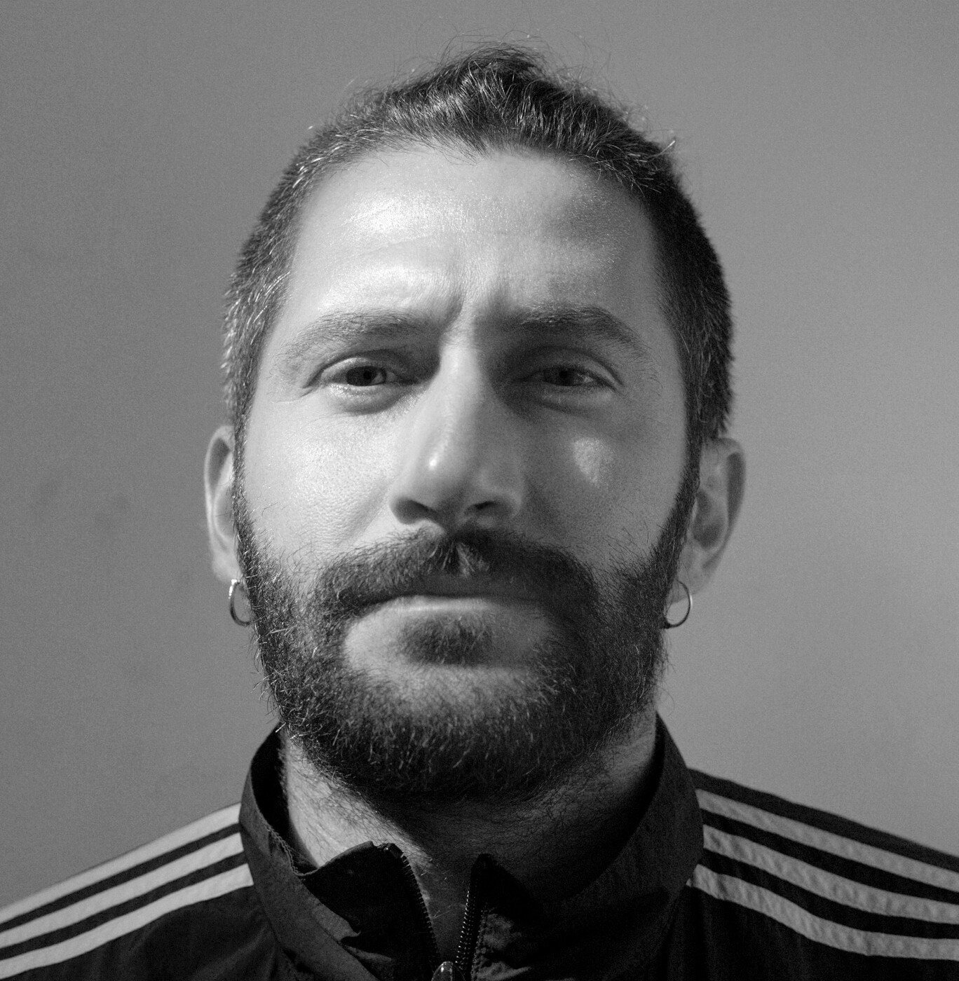
Felice Rosa is an Italian documentary photographer and a member of Hans Lucas press agency. His work consistently engages with questions of borders, displacement and environmental change. Early in his career he documented life in the Choucha refugee camp near the Tunisia-Libya border, capturing the human consequences of contested frontiers and the bureaucratic abandonment of displaced people. He also photographed protests and social struggles in Zarzis, Tunisia, where local communities confronted migration policies and state repression.
Other significant early projects include reportage from Kobane on the Syria-Turkey border, and longterm visual studies of urban transformation in Marseille and the effects of drought on agricultural landscapes in Sicily, where climate change reshapes both livelihoods and ecosystems. His images reflect a commitment to bearing witness to lived realities at the intersections of geopolitical constraint and everyday life.
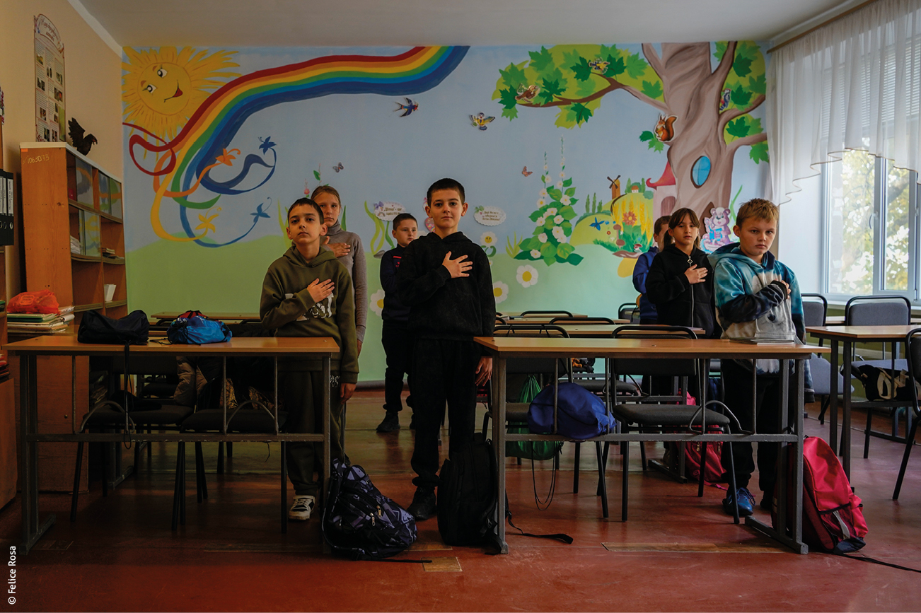
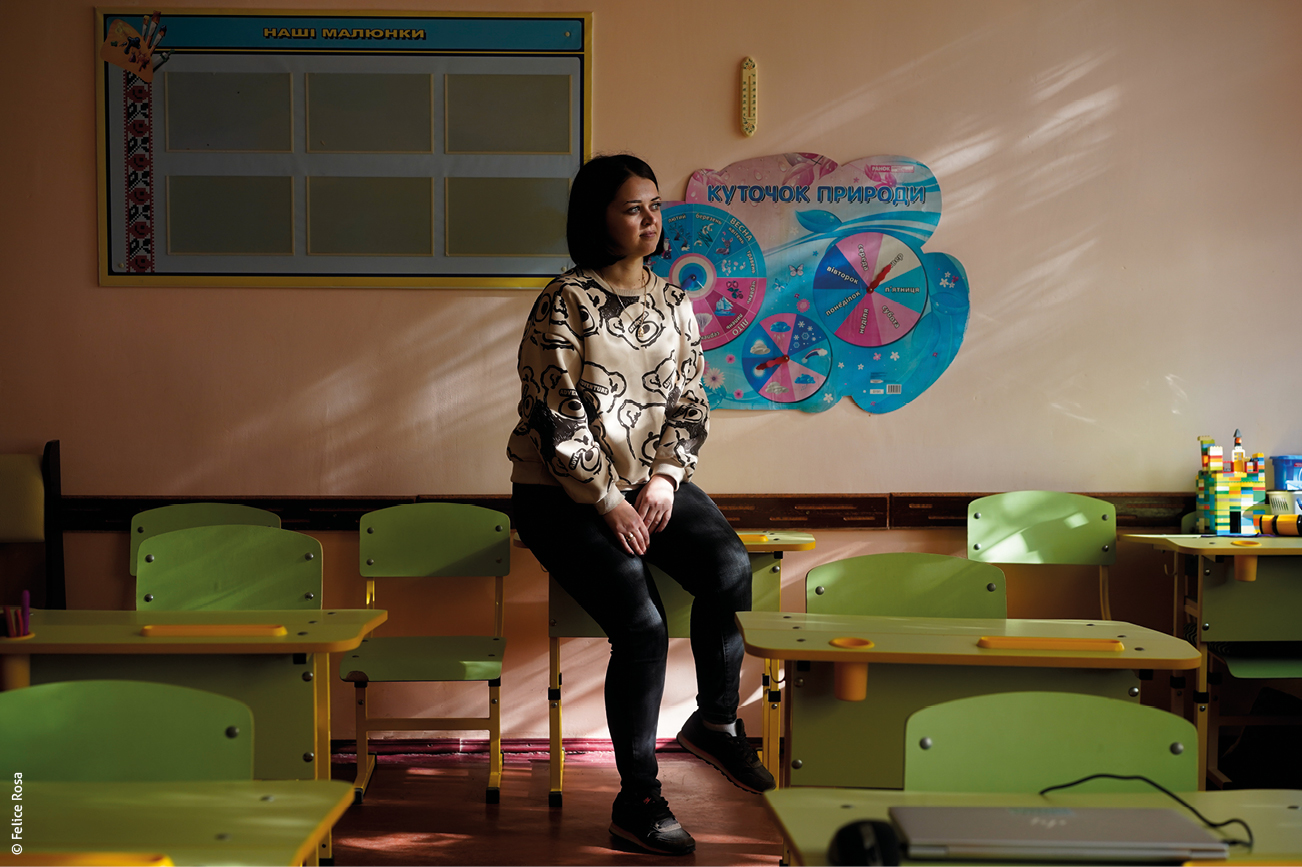
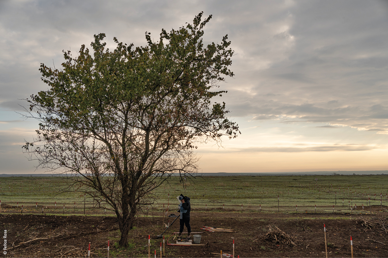
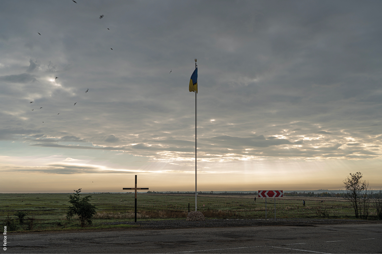
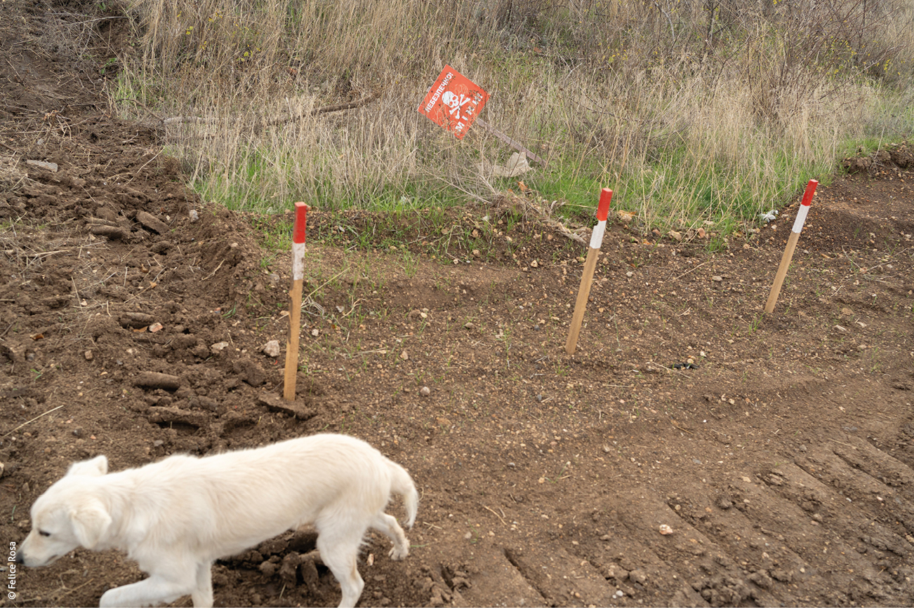
In October 2025, Felice Rosa documented the humanitarian and environmental impact of mines in Ukraine, focusing on clearance operations and the pervasive risks these weapons pose to rural communities, agriculture and mobility. His work captures how explosive hazards shape both daily life and longterm recovery.
The project also engages with changing international norms: in May 2025 Ukraine formally withdrew from the 1997 Ottawa Treaty banning antipersonnel mines, a step mirrored by countries including Poland, Finland and the Baltic states, raising complex questions about landmine policy amid ongoing conflict.
See also, in this issue, Jean-Baptiste Richardier, “Back to the killing fields? Anti-personnel mines return from the dustbin of history”.
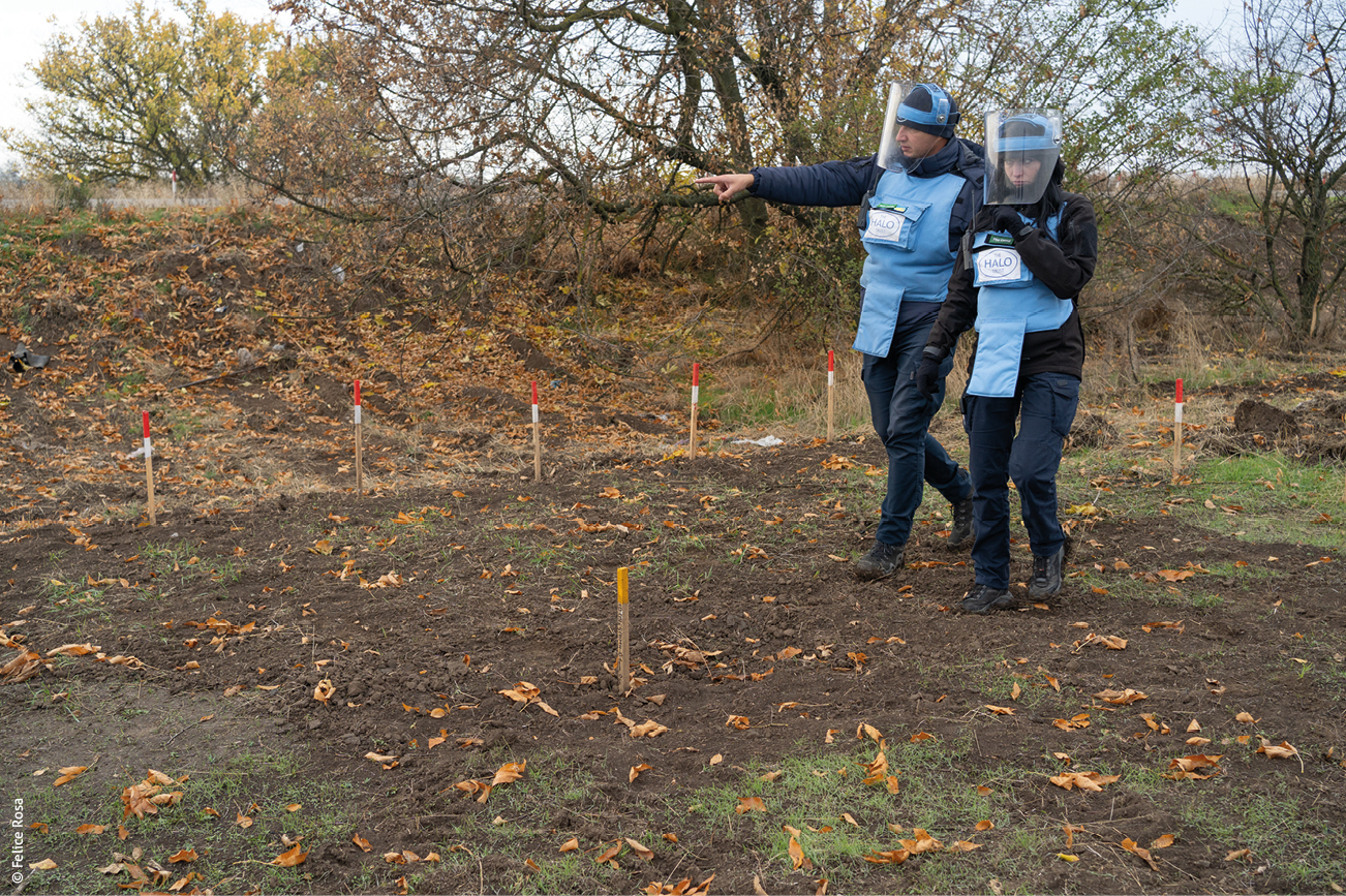
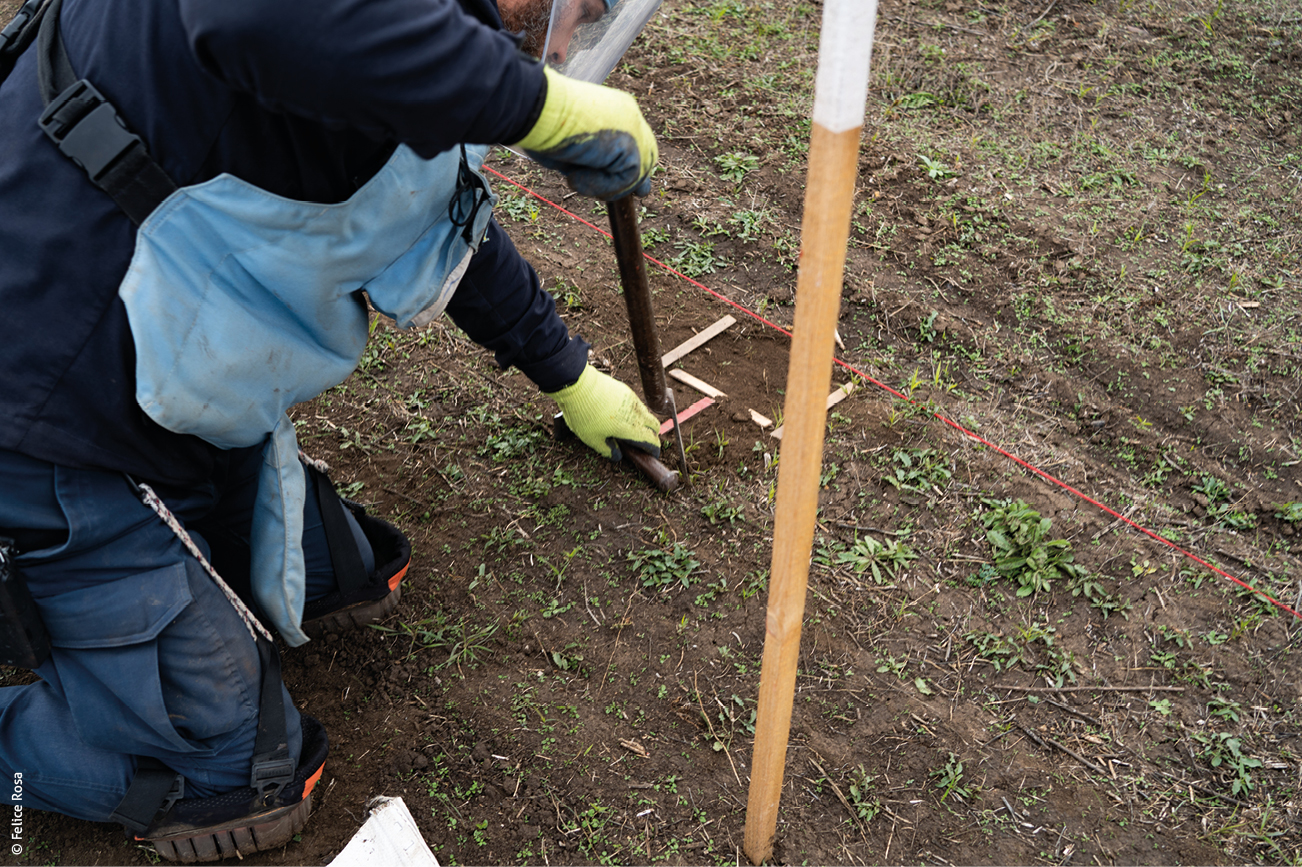
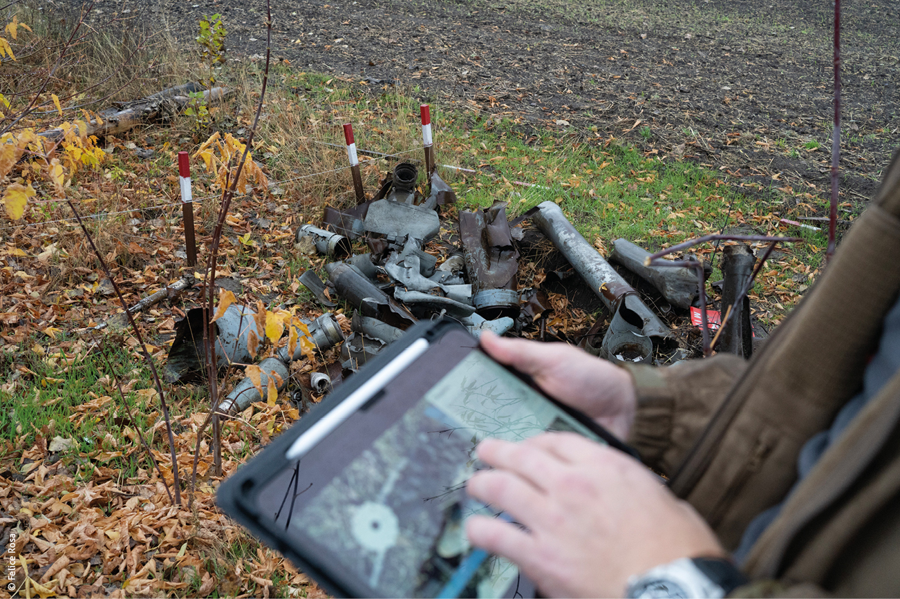
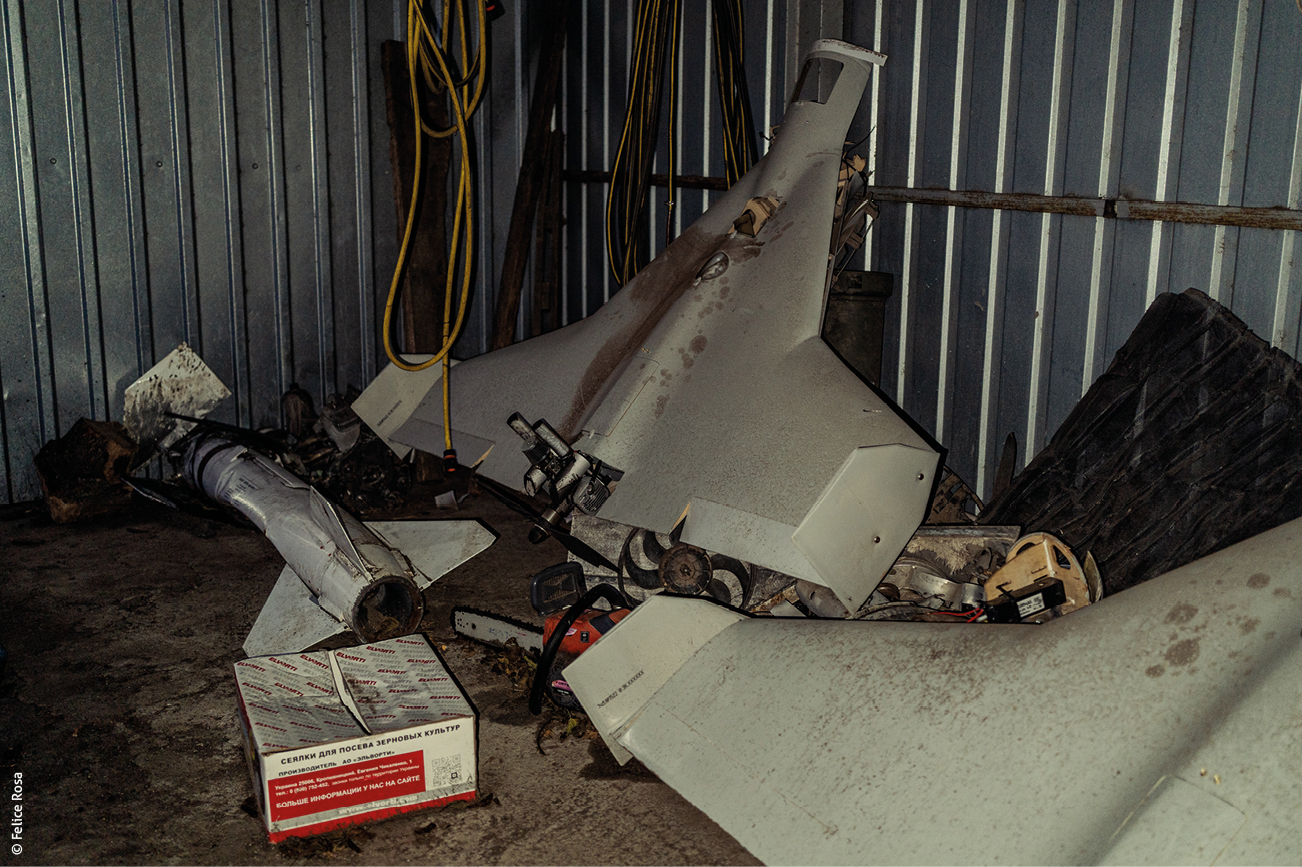
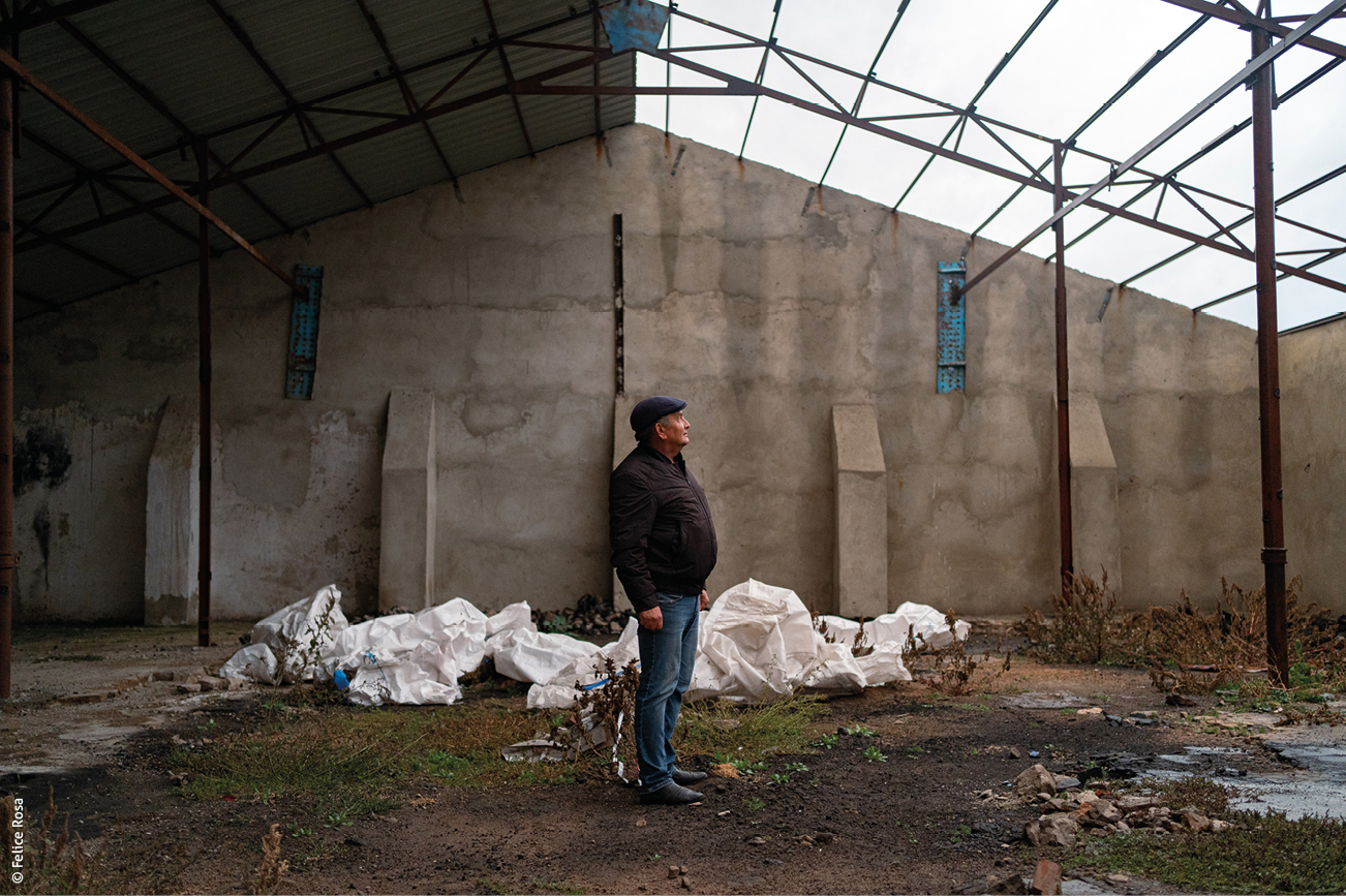
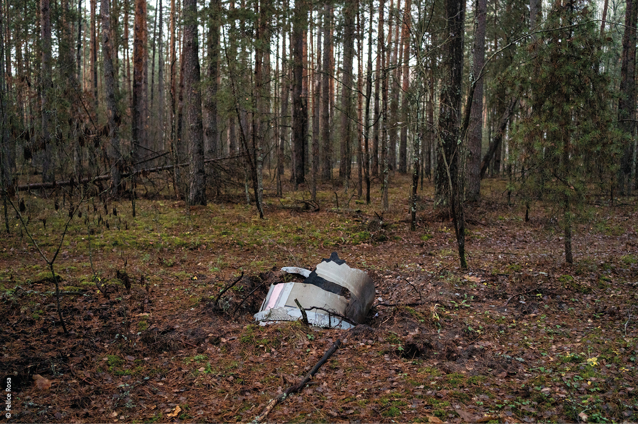
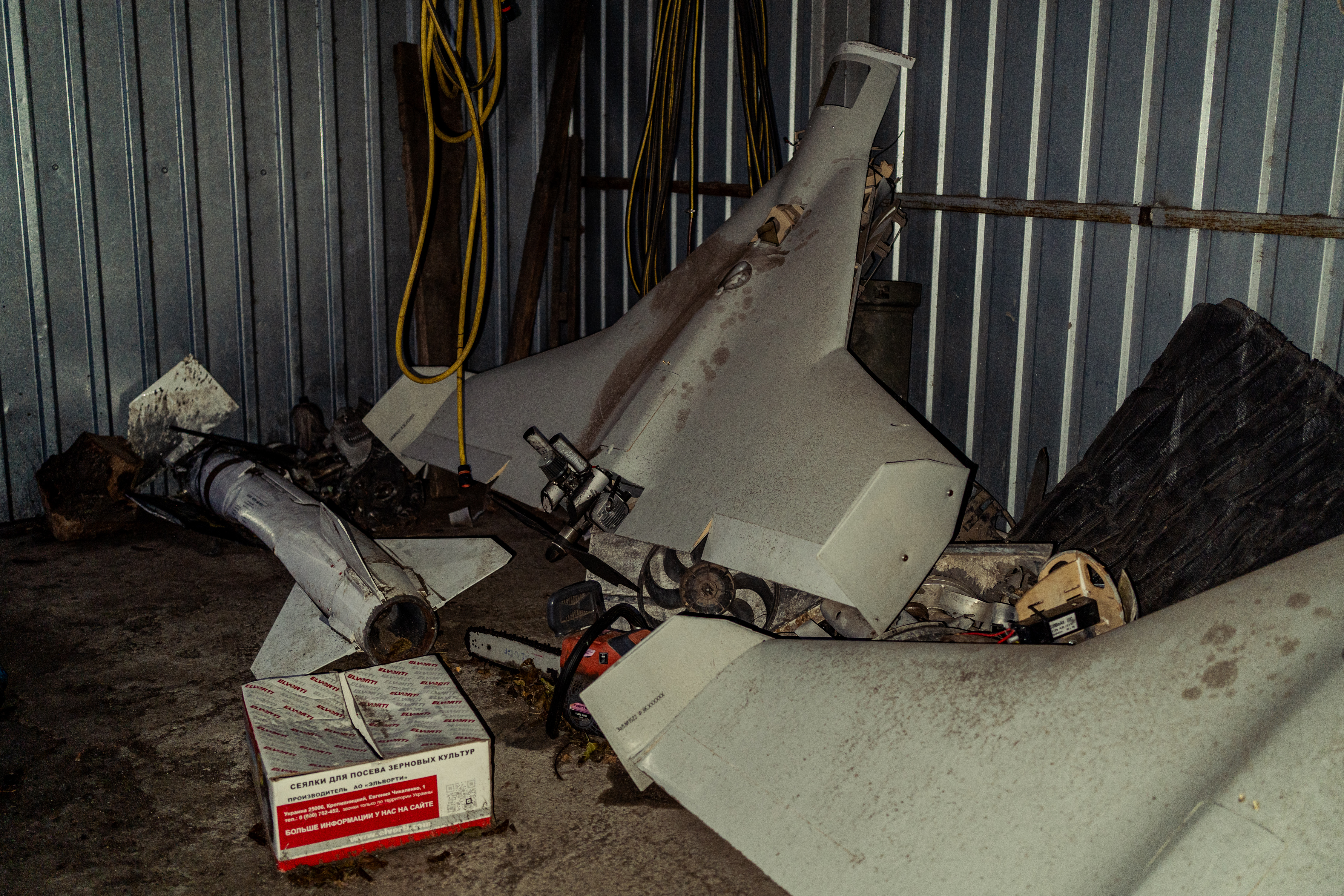
“Everyone has been affected by the mines. There have been accidents in the fields: our tractor hit a mine, a child died and we still live in danger,” testifies Yroslav, a farmer in Yevhenivka, in the Mykolaiv countryside in southern Ukraine. Three years after the withdrawal of Russian forces on 7 November 2022, the villages and land along the former front lines remain severely affected: anti-personnel mines and unexploded munitions threaten daily life. According to Ivan Kukhta, the military administrator of Snihurivka, more than 10,000 hectares are classified as high risk. Since the region’s liberation, 41,243 hectares have been cleared, mainly agricultural land, while at the national level 9.8 million hectares remain unusable. More than a hundred organisations – public, private and non-governmental – are taking part in demining operations.
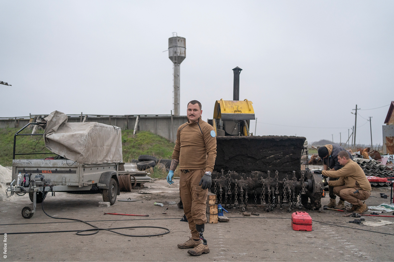
Andrei, the HALO Trust’s field officer for Novopetrivska, Yevhenivka and Snihurivka (villages crossed by the front line in 2022), reports that the NGO has neutralised around 15,000 mines and other unexploded munitions in the Mykolaiv region. According to governmental official sources, in 2025, roughly 70,000 unexploded devices and mines had been removed from the Mykolaiv region and 26,000 hectares of land had been demined. In 2025, the Economy Ministry, responsible for coordinating clearance operations, launched an acceleration plan that includes the following: a budget of three billion hryvnias (UAH, approximately 60 million euros); reimbursements covering up to 100% of costs for farmers; opening markets via the Prozorro platform; increasing the number of certified operators; and training programmes.
At the end of October 2025, the international conference on mine action, held in Tokyo and organised by Japan and the United Nations Development Programme, brought together representatives from more than thirty donor countries. It resulted in the creation of a $150 million (USD) fund to modernise equipment, train local teams and coordinate operations in the hardest-hit regions, such as Mykolaiv and Kherson.
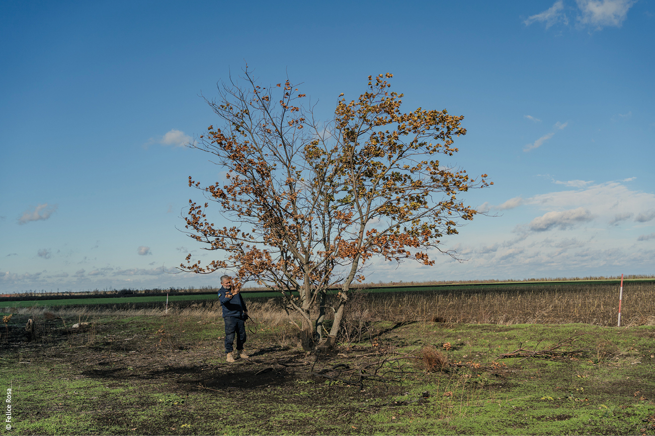
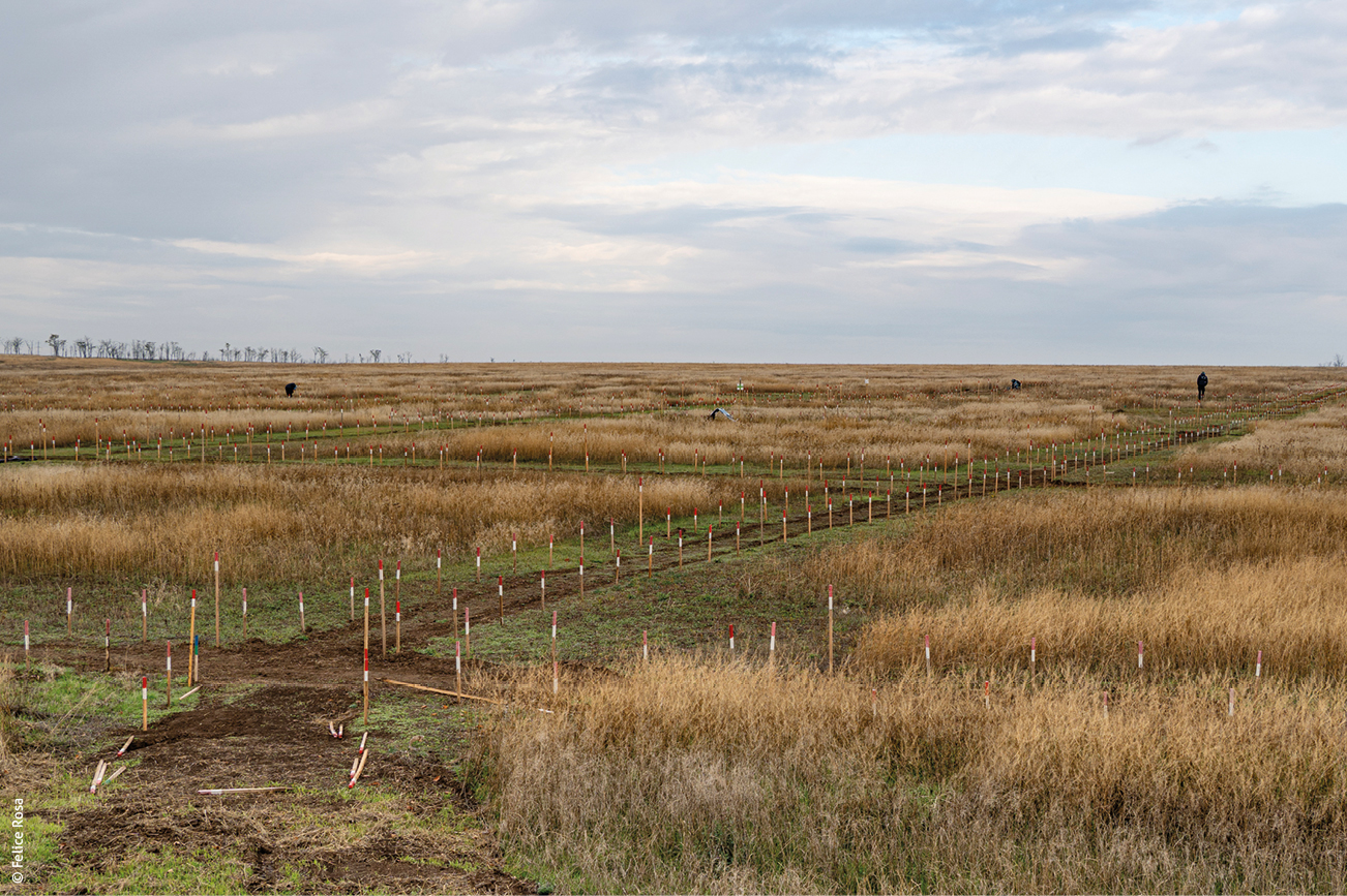
Demining operations, risk-education sessions and reforestation projects underscore both the persistent scale of the threat posed by mines and other unexploded devices to Ukraine’s reconstruction, and the resilience of communities confronting a war legacy deeply imprinted on the land.
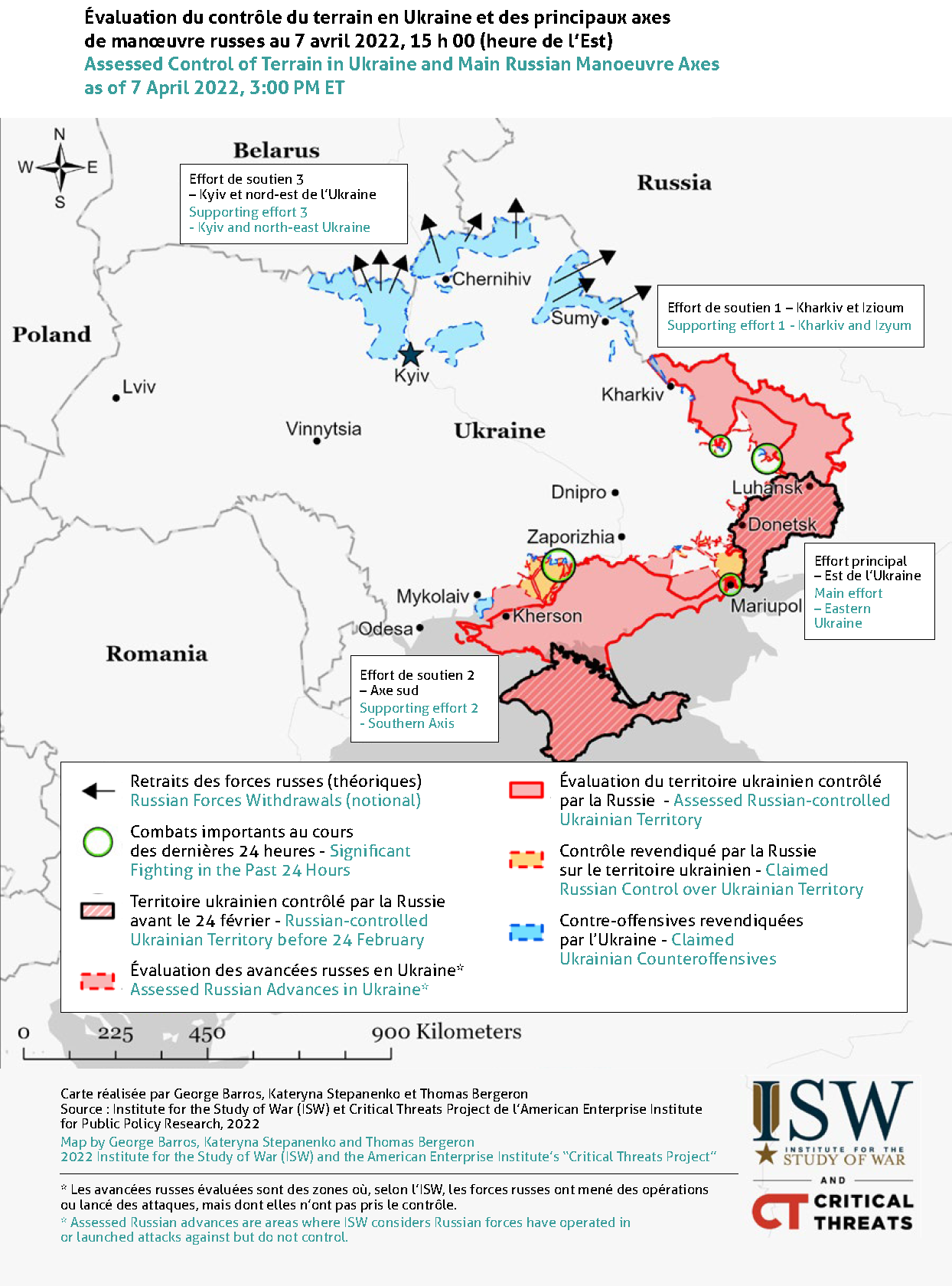
Note (by ISW): The disorderly withdrawal of Russian forces from around Kyiv makes precise mapping of the situation in the Kyiv, Chernihiv and Sumy oblasts difficult. There are likely no organised Russian defensive positions in these oblasts, but Ukrainian forces are conducting operations to clear “lost orcs” – Russians left behind in the withdrawal. We will not attempt to map these clearing operations. Ukrainian forces may have already regained control of more of the Chernihiv and Sumy oblasts than we depict, but we do not yet have sufficient evidence to adjust our assessed areas of advance beyond those shown here. The situation will likely clear up over the next few days, and we will adjust the advance and/or control lines accordingly.
Note (by Felice Rosa) : The map shows the territories (in red) occupied by the Russian army, followed by the Ukrainian army’s counteroffensives (in light blue) as of 7 April 2022. The photo report was taken in the areas marked in blue: north of Kyiv, south of Ukraine in the Mykolaiv Oblast, and in the Kharkiv Oblast in the east of the country.
Note (by Humanitarian Alternatives) : The Institute for the Study of War (ISW) and the American Enterprise Institute are two think tanks widely regarded as neoconservative, warmongering and linked to the United States government. For an interactive, evolving map of the situation in Ukraine, based on information from the ISW but cross-referenced with data from the Australian Strategic Policy Institute and the War Mapper project, see: « Les cartes de la guerre en Ukraine, depuis le début de l’invasion russe », Le Monde, 10 juin 2025, (map updated every week – In French only)